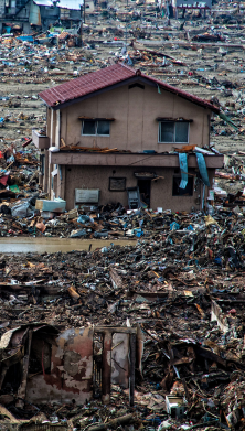
Drones and satellite imagery also helped to assess engineering claims after recent natural catastrophes, such as wildfires in California and Hurricane Florence in 2018. This enabled loss adjusters to get a quick overview of damage, as well as assess claims in hazardous or inaccessible areas.
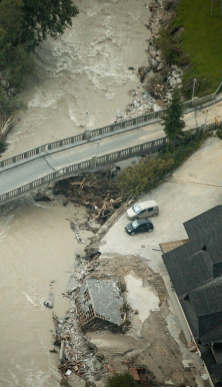
Together with the geodata factory of engineering firm IABG, AGCS has also developed a new kind of flood risk survey based on topographic data from drones in order to model flood and drainage behavior on construction sites. Preparation work on construction sites can change site elevations and often disrupt natural water courses and drainage, creating obstacles such as the build-up of water during heavy rainfall meaning flood exposures can change throughout the course of construction activities. By coupling 3D topographical data with hydrogeological modelling software and rainfall simulation data it is possible to assess water flow across a construction site and predict flash flooding risk.
At the same time, satellite technology is proving particularly useful for engineering claims, offering high resolution images of a site within 24 hours of a loss. It can give adjusters information on engineering risks in remote or hazardous locations, as well as provide data to tackle exaggerated or fraudulent claims. For example, AGCS used satellite imagery to remotely monitor the construction of a hydro dam which then reported an incident. Adjusters were not able to visit the dam, but satellite data showed damage to the dam was not as extensive as claimed.
Technology will create more certainty for engineering claims, according to Hogendoorn: “There are so many parties on a site at one time, and so many activities happening simultaneously, it can be extremely difficult to understand the sequence of a loss event. However, we can increasingly use technology to access data and information to better understand the root cause of loss and speed up the claims process.”